It’s not going to be the best time to surf this week for a good portion of SoCal due to the major oil spill off the coast of Huntington Beach.
Overview
As of right now the water is closed from HB to Dana Point, and as the prevailing current/wind pushes the oil farther south it could start affecting more beaches towards San Clemente and possibly even San Diego. If you’re unsure about your beach’s status on the oil spill, wait and check with the most recent updates for your area.
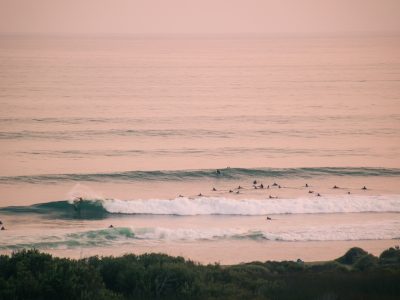
Surf-wise, it’s not going to be the best week either. Most of the forecast will see small size surf until Sunday the 10th as a fresh Southern Hemisphere swell begins to fill in. This swell will top out Monday the 11th and hold into Tuesday the 12th. During this peak in southerly energy, we expected to see a locally solid NW windswell on top of it. These few days will see the biggest surf, but conditions are looking a bit rough during the peak of the swell.
We’re entering a pretty significant pattern change this week, as multiple early-season troughs affect the region. Temperatures will be below average for most of the week until the end of the forecast as temperatures dip down to well below average for this time of year.
The first trough to enter the region will be on Thursday evening into Friday, bringing a chance of showers. Local winds don’t look too strong with this system, but still lightly onshore resulting in mostly unfavorable conditions.
The next trough looks much stronger than the first but with not as much precipitation. Stronger local winds and colder temperatures are expected with this second system.
Read more about the oil spill or how to volunteer @Surfrider

Best Bets
– Monitor the oil spill. Make sure you have clean ocean access if looking for a surf, especially as the oil makes its way down south in the coming days.
– Decent sized combo of swells Monday the 11th to Wednesday the 13th.
– Mostly unfavorable conditions during the peak of the swell, but some possible windows.
– A strong low pressure system is expected to impact our region Tuesday the 11th with gusty west winds.
Day to Day Overview
Thursday the 7th: 1-3 feet
Pretty small mix of swells running. Just some minor south swell and minor NW swell. Morning winds look lightly onshore and afternoon winds don’t look too strong. Slight chance of showers through the day, but nothing heavy.
Friday the 8th: 1-3 feet
Small mix of swells continues. Morning winds look lightly onshore again too. Chances for showers increase as activity peaks in the morning hours. Afternoon onshores pick up out of the west.
Saturday the 9th: 1-3 feet
Another small day of swell. Small south swell will still be in the water as a new minor pulse of NW windswell shows. Morning winds are trending favorable, with glassy conditions likely. Afternoon onshores pick up out of the west.
Sunday the 10th: 2-3+ occasional 4 feet
Fresh Southern Hemisphere swell starts to build in, showing bigger sets later in the day. Even though the morning will start off slow, it will be one of the better mornings to target throughout the forecast as morning winds look to cooperate. Afternoon onshores look to pick up from the west, but possibly not strong enough to count out an evening session with the building swell in the water.
Monday the 11th: 3-4+ occasional 5 feet
Bigger than Sunday as south swell tops out. The morning may not be as clean, with possible south wind forecasted for part of the region. New NW windswell may rapidly fill in before dark and add more size for winter time breaks. Afternoon winds are looking pretty unfavorable for most of the region.
Tuesday the 12th: 4-6 feet
Biggest day in the forecast, but a blow through in west winds is looking likely all day. South swell holds, and NW windswell peaks in the morning. If looking for a surf find somewhere that is west wind protected.
Wednesday the 13th: 3-4+ occasional 5 feet
South swell is on the slow easing trend, as leftover NW windswell shows. This may be the best day in the forecast if the morning wind cooperates. Right now it’s too far out to say, but models have been indicating clean morning conditions. Worth keeping an eye on.
– Jax Richards @jax6street
If you’d like to receive these day by day forecasts every week, sign up for our newsletter