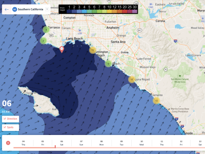
Overview
11/12/21-11/18/21 – There won’t be as much swell as last week, but more fun days of combo swell are lining up throughout this week’s forecast. Both the North and South Pacific are beginning to take a breather. Although that isn’t what we want to hear, it has been quite the run of swell these past few months.
This week is still looking fun though, with some WNW swells, and a few southern hemisphere swells. There will be a new round of small south swell over the weekend, and another slightly larger south swell early in the workweek. Another south will start building towards the end of the forecast as well. There will be two new noticeable pulses of WNW this week. The bigger swell of the pair will show best Monday the 15th.
The combo breaks will be the call most of the week, but there will still be some options for the summer and winter spots too.
Usually this time of year as we head deeper into November, we’ll start talking about more precipitation chances. But this year, along with many other recent Novembers, is looking almost entirely dry. It’s not a coincidence either, it’s a trend we’re seeing in California as our climate changes and warms. Although we did see a few rare October storms this year, decreasing autumn precipitation is a clear trend, and it’s pushing SoCal’s start of the rainy season farther back.
We’re going to start off the forecast very warm for this time of year. Friday will be the warmest day, with many coastal areas exceeding 80 degrees! We’ll see a gradual cooling trend through the weekend and into the workweek as the upper level high slowly weakens. More seasonal temperatures along with low clouds will return by the workweek. Mornings over the weekend will see calm conditions, and will remain fairly light each morning through the rest of the week. Our local water temperatures are mostly running in the low 60s, so overall, things aren’t that cold across SoCal for this time of year.
Best Bets
– Friday & Saturday will be smaller, but warm weather will prevail along with favorable conditions.
– Combo of swells picks up Sunday/Monday with more size across the region.
– South swell will continue through the week, but winds may trend unfavorable by Wednesday.

Day to Day Breakdown
Friday the 12th: 2-3 feet
Small, but will be nice and warm with clean conditions most of the day. Select areas will see light offshore wind early, and trending light onshore from the west in the afternoon for the entire region. Still a day to target with fun leftover combo swell in the water.
Saturday the 13th: 2-4 feet
Another nice day with mostly light winds. A little bit more south will show on top of the leftover NW swell mix. So targeting the summer/combo breaks this day is the call. Could be a good day for a morning and afternoon session.
Sunday the 14th: 2-4 feet
Little combo of swells continues. South swell energy will hold, and WNW energy will rebound slightly. Morning winds will be calm, followed by a light onshore breeze in the afternoon. The morning window will probably be the call, but afternoon winds look light enough for a surf too.
Monday the 15th: 3-4+ feet
Looking like the biggest day in the forecast. That new WNW pulse will show more, and south swell will pick up a notch. Combo breaks will be the call, but both summer and winter breaks should see fun surf. The morning will see calm conditions, followed by a light seabreeze in the afternoon.
Tuesday the 16th: 3-4+ feet
Similar size to Monday for the spots that receive the southerly angle, but for the winter spots it will be a notch smaller as WNW eases. This should be another fun morning across the region as morning winds remain light. The afternoon will see less favorable conditions as onshore wind picks up.
Wednesday the 17th: 2-4 feet
Overlapping fun south swells and leftover WNW mix. Morning session could be fun, but watching the possibility of south wind getting on it. The morning high tide will slow things down a tad as well. There could still be some opportunities throughout the day though.
Thursday the 18th: 2-4 feet
South swell remains dominant as more swell fills in. Could see some NW windswell, but it looks minimal right now. Target those summer breaks, and keep an eye on local winds as things may trend onshore for the morning. Watch the morning high tide as well.
Long Range Forecast
As I said earlier, things are looking a lot slower through the rest of November. Last week I said I think we’ll see swell from the South Pacific until at least the end of the month, but it’s looking like it’s going to shut down a bit sooner than that. The North Pacific isn’t looking too hot through November either.
Weather-wise, there are no signs of meaningful precipitation for SoCal. This isn’t great news for our current drought situation, as well as our fire season with fuel moisture still pretty low for SoCal’s foothills and coastal ranges. Looking ahead into the heart of winter, most signals I’m seeing right now continue to indicate higher than normal pressure dominating the Eastern North Pacific. This would lead to another drier than normal winter and a slower winter of surf. This is just something to keep an eye on, as it is still pretty far out. Things will most likely change to an extent as we head closer to December.
– Jax Richards @jax6street
If you’d like to receive these day by day forecasts every week, sign up for our newsletter