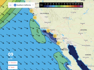
Overview
1/28/22-2/3/22: After a pretty good run of WNW swell through much of January, things are finally slowing down as we head into the month of February. Other than some leftover WNW groundswell to start off the weekend, not a whole lot of swell is expected to come from the far NPAC compared to last month. Unlike the past few weeks, we should see some localized NW windswell for the region toward the end of the forecast and beyond. The possible NW windswell this week should peak Tuesday February 1st and ease into the 2nd. A little bit of activity has been going on in the South Pacific, so expect a few days of minor Southern Hemisphere swell mixing in during the week.
January is going to end on a dry note, and the beginning of February looks to continue that way as no rain is in the forecast. Instead, more Santa Ana wind events are on the way. To start off the forecast on Friday the 28th, we will see a moderate strength Santa Ana, with some select areas seeing offshore flow all day. Offshore winds will linger into Saturday as they weaken. Things will cool off a tad into the workweek as fair weather persists. The forecast becomes uncertain starting Tuesday the 1st and into the 2nd as a trough digs in from the north. Depending on the location of this trough, another Santa Ana wind event is possible Wednesday the 2nd.
Best Bets
– Friday the 28th as leftover WNW groundswell shows and offshore flow returns.
– The weekend could still be fun as small WNW swell shows and mornings remain clean.
– Possibly the morning of February the 2nd as NW windswell eases, but conditions could clean up.
– Watch the high tide each morning.
Day to Day Breakdown
Friday the 28th: 2-4 feet
One of the better days in this week’s forecast. There will still be some fun WNW swell in the water from last week and moderate offshore wind is expected for the morning. Depending on the location, winds will stay offshore through the day. Go get some waves before things die down.
Saturday the 29th: 2-3 feet
WNW swell eases from Friday showing rideable surf for most areas across the region. Offshore flow lingers, but will be much lighter than Friday. The conditions for the afternoon don’t look too bad so that could be an option too. Best call is probably mid to late morning to let the tide drop.
Sunday the 30th: 2-3 feet
Similar size to Saturday as smaller WNW swell hangs in there. Conditions will be mostly clean in the morning as light wind is expected for most of the day other than a touch of south wind. The morning will start off slow as high tide swamps things out. Tide drop is probably the call again if you’re looking for a surf.
Monday the 31st: 1-3 feet
Small swell mix bottoms out and deep high tide in the morning does not help the cause. Winds are looking fairly light for most of the day, but it will be a challenge to find fun surf.
Tuesday the 1st: 2-4 feet
Size increases through the day as a fresh NW windswell is expected. Even with this new pulse of swell in the water, it’s not looking like a great day to target. Another morning of high tide along with possible textured conditions will make it hard to find fun waves. NW windswell magnets should be the best call if there are any early windows.
Wednesday the 2nd: 2-4 feet
NW windswell will drop off pretty fast, with best size showing during the morning hours. This morning window could be one of the better days in the week as offshore flow looks to return. Find a spot that can handle the short period NW windswell as well as the deep morning high tide. A little bit of southern hemi may be making its way in for some south facing breaks too.
Thursday the 3rd: 2-3 feet
Just a minor mix of NW swell and south swell. With the late morning high tide and small combo of swells, the best call could be the beach breaks with a good sandbar. Conditions too uncertain to say at this time.
Long Range Forecast
Hope everyone got some waves during January’s run of swell, because models continue to indicate a much slower month in February. There should still be some modest pulses of WNW here and there that will result in fun surf, but nothing like we saw the last few weeks.
There should also be a bit of Southern Hemisphere swell through the month keeping things rideable for summer magnets, but nothing impressive. Weatherwise, models have backed down significantly for February’s potential pattern change. Things will remain dry through at least the next few weeks with no significant storms on the horizon.
– Jax Richards @jax6street
If you’d like to receive these day by day forecasts every week, sign up for our newsletter