Another week of small and sloppy surf is in store for the holiday’s.
Overview
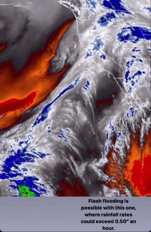
12.24.21-12.30.21 – On a positive note (at least for some), is that more rain is in the forecast, and cooler temperatures look to continue into the new year. One thing to note this week is that the global weather models (Euro and GFS) are really split on solutions, so there’s less confidence on exact timing and strength on some of these upcoming storms.
The main story this week in terms of swell will be localized windswells, due to continued high pressure dominating the North Pacific near the Gulf of Alaska. To start off the forecast, Christmas Eve will see a small to medium sized westerly windswell peak through the day, and then ease through the day on Christmas. We’ll see another west windswell peak early in the week around Monday the 27th. More windswell is possible later in the forecast, but exact size and timing is still uncertain. Even if there is more size with these swells, each day will be pretty jumbled along with poor conditions.
After a nice soaking Thursday the 23rd thanks to that strong atmospheric river event, a few leftover showers will linger across the region on Christmas Eve. A colder but weaker system with less moisture will bring showers to the region Christmas night. This is when our colder stretch of weather really begins. The colder air will be from the modified arctic outbreak the Pacific Northwest will be experiencing through the end of the month. After Christmas another storm will impact the region Monday the 27th, with more rain and west winds. The final days of the forecast may see yet another storm system approach the region, but confidence is low on this one. There is a chance this one could be stronger than the last few so it will be worth watching. Each morning and afternoon will see onshore wind, with not many windows in between. Overall, it’s going to be pretty hard to find a clean day of surf this week.
Best Bets
– Enjoy the cold and unsettled weather during the holidays.
– No specific day to target, just sloppy windswell all week.
– Keep an eye on each storm system, especially the one at the end of the forecast for any limited windows.
– Water quality may be on the dirtier side again this week.
Day to Day Breakdown
Friday the 24th: 2-4 feet
Christmas Eve starts out choppy with not many rideable waves to be found. Even though west windswell will be up, onshore winds will make it hard to find anywhere clean. Good day to take off, and spend time with friends and family.
Saturday the 25th: 2-3 feet
Not a whole lot of swell for Christmas Day. West windswell eases, showing best size early. Morning winds will be lighter and a bit cleaner than the day before, so there may be a window earlier in the day. Other than that though, not a great day to get in the water.
Sunday the 26th: 2-3 feet
Size remains small as just minor northwest windswell shows. Winds may be slightly more favorable in the morning, but still a light west wind on it. Another day of bad surf.
Monday the 27th: 2-3 feet
Leftover windswell and another new windswell building in. Nothing major, and continued onshore flow will blow things out once again. More rain on the way through the afternoon, but it will be a quicker and colder system.
Tuesday the 28th: 2-4 feet
NW windswell peaks overnight and eases through the day. Things will still be pretty small and jumbled, but the morning wind may cooperate. Even if conditions clean up, it won’t be too good.
Wednesday the 29th: 2-3 feet
Complex forecast from here on out. We could see a stronger low pressure system move into the region, bringing more rain and larger windswell. If looking to score anything fun, don’t count on anything great.
Thursday the 30th: 2-4 feet
Still watching that possible low pressure system to make its way through the region. If timing gets pushed back, then it will impact SoCal this day instead of Wednesday. Rain and jumbled windswell is possible.
Long Range Forecast
Same story as the last few weeks. Persistent ridge of high pressure over the Gulf of Alaska has prevented any major storms in making their way through the North Pacific and delivering us any substantial longer period WNW swell. Luckily, this ridge has been west enough, where we have been able to get multiple localized storm systems and deliver us rain and mountain snow. This pattern looks to continue for at least the next few weeks. So again, no major WNW groundswells on the horizon unfortunately.
– Jax Richards @jax6street