Overview
Hope everyone got some waves this past weekend, and if you didn’t, don’t stress, we got more fun surf on the way. Just not quite as big as it was last weekend.
–
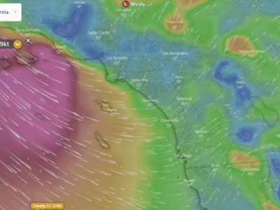
We have two more rounds of southern hemi on the way, thanks to continued activity in the South Pacific. The first pulse of southern hemi (~195°) will move in Wednesday the 28th and peak Thursday the 29th. This swell wasn’t aimed too well at SoCal, but we should still get some fun surf from it.
–
The next swell was aimed better at SoCal, and will be a bit bigger than the one we’ll see during the week. This slightly bigger swell (~180°) will begin to show later in the day Friday the 30th, and peak over the weekend. There will also be some small NW swell in the water over the weekend breaking up some of that southern hemi for a few corners at the beach breaks. *See the 10 day forecast MAPS
–
Good and bad news for the conditions this week. The good news is that the conditions look pretty favorable Wednesday the 28th to Friday the 30th as a strong ridge of high pressure builds in, resulting in warm temps and light morning winds. The bad news is that the winds look like they will trend onshore over the weekend when the second south swell peaks. That being said, the conditions over the weekend don’t look horrible, so there should still be some fun windows of surf if you time your session right.
–
During the spring heatwave we’ll have some fun-sized southern hemi (~195°) to go along with it.
Forecast maps updated daily. *10-Day Forecasts for Premium Members (View HERE)
Best bets, tips
Wait for the mid-morning tide push Thursday/Friday for the best windows of surf.
Could still still be fun over the weekend, just keep an eye on the winds.
A strong ridge of high pressure will build in late week, resulting in clean morning conditions and warm temperatures across SoCal.
Daily Breakdown
–
Tuesday the 27th: 3-4 feet
Worst day of surf all week. Lingering southern hemi from this past weekend will still be showing a few fun waves, while a new minor NW windswell pulses up slightly. It could be kinda fun if the winds sit down enough, but most weather models are showing a light south wind in the morning across the region.
–
Wednesday the 28th: 3-4 feet
Size is similar to Tuesday, but conditions will be cleaner in the morning. First pulse of southern hemi (~195°) will build in through the day showing best size late, but the afternoon onshores look too strong for an afternoon surf for most spots. There will also be minor NW windswell still mixing in.
–
Thursday the 29th: 3-5 feet
Fun day of surf. Southern hemi (~195°) will build to a peak and show 3-5 foot surf for summer breaks. Conditions will be really nice with light morning winds and warm temps across the region as that ridge builds in over California. Best window will be the mid-morning tide push.
–
Friday the 30th: 3-4+ occasional 5 feet
Another day of fun surf and clean conditions. Southern hemi (~195°) eases slowly, as the second southern hemi (~180°) shows late, but not adding any additional size. It will be as warm if not a few degrees warmer than Thursday, so it will be a super nice day to get in the water. The winds look pretty light even into the afternoon too.
–
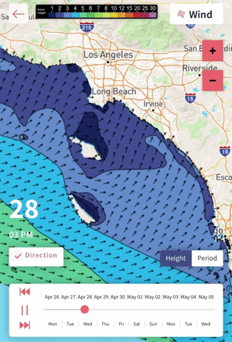
Saturday the 1st: 3-5+ feet (select south facing spots like OC will be slightly larger on sets)
The second southern hemi (~180°) will build to a peak, showing biggest surf in the afternoon. There should also be a little upstick in NW windswell along with minor NW groundswell, so there should be a few corners at the beach breaks. Winds look to trend onshore, so not as clean as it was the past few days, but it looks manageable right now.
–
Sunday the 2nd: 3-5+ feet
South swell (~180°) will hold steady all day, showing some fun-sized surf for the south-facing breaks. NW windswell looks to trend up even more than Saturday, so it should be pretty peaky at the beach breaks. Unfortunately, the winds also look to trend a bit more onshore than Saturday, so most breaks will probably be dealing with a light south wind in the morning. There will also be a new small long-period WNW groundswell in the background, but will not be showing much size in SoCal due to the distance the storm was in the North Pacific.
–
Monday the 3rd: 3-4+ occasional 5 feet
The south swell (~180°) will begin its slow easing trend, still showing as the primary swell, while some NW windsell continues along with the small long-period WNW groundswell. As of right now the winds aren’t looking too good with more south wind in the morning across the region. If the winds cooperate this could be a fun day of peaky surf at the combo breaks.
–
If you’d like to receive these day by day forecasts every week, sign up for our newsletter here: