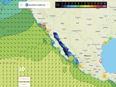
OVERVIEW (2/17 – 2/19): After a busy week, this weekend should be pretty quiet. The northwest groundswell we experienced over the past week will be departing the area making way for the next round of swell for the weekend. Unfortunately, it looks like we will only get a glancing blow of swell this weekend as the storm system that’s bringing it will take a different path staying further west from the previous one.
So, the bad news is that the ground swell won’t be big, but the good news is that because the low stays further west, we won’t have very strong winds and the overall weather looks pleasant. In fact, there won’t be any kind of front with this system and that’s why we expect light to variable winds all weekend.
Temps will stay fairly consistent through the weekend as well. It may be a little cloudy across some areas both north and south on Friday but after that the sun should come out and stay out for the rest of the weekend. Los Angeles will have highs near 70 degrees for Friday, Saturday, and Sunday while San Diego and Santa Barbra will be slightly cooler in the mid-60s all three days.
TLDR: If you want the GO vs No-GO call, this weekend is a GO, if you’re willing to brave the cold temperatures and small-ish surf. But keep your expectations low. Bigger waves in San Diego or Ventura.
Subscribe to see the full 10-Day Forecasts
BEST BETS
-Friday afternoon looks like a good time as swell picks up slightly and winds remain very light. Temps will be in the mid-60s.
-Saturday Morning will be when waves are best as we see ground swell die down throughout the day. Winds continue to stay light and offshore for most locations.
-Sunday afternoon we will see ground swell from the west to pick up slightly although still nothing impressive is expected.
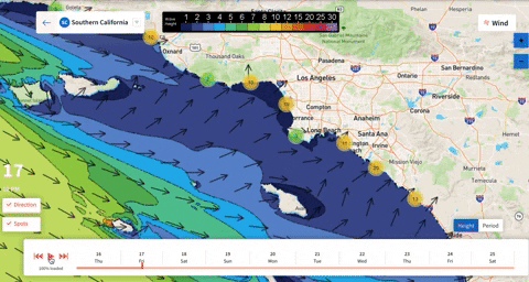
FRIDAY MORNING
It will be cloudy to start the forecast period off as mid-level clouds roll in from the west. No rain is associated with these clouds and they also won’t prevent our highs from reaching the mid-60s later in the afternoon. Lows will be in the mid-40s area wide. Winds will be offshore for everyone and thankfully they stay light (under 10 mph) for almost everyone except near Oxnard where they could be around 15-20 mph.
A west ground swell will be in place but unfortunately it looks to stay very weak through the entire morning. The highest waves will be near the border at around 4 ft. Other than that, west facing beaches can expect 2 ft swells while south faces can expect 1 ft swells. Periods are expected to be around 14 seconds on average.
FRIDAY AFTERNOON
Not much will have changed by the afternoon hours. We expect clouds to stick around but are highs will still reach the mid-60s for San Diego and Santa Barbra while LA could reach 70. This is thanks in part to light Santa Ana winds that will stick around throughout the day.
Winds appear to weaken and become disorganized by the afternoon hours so the relatively quiet conditions will continue. The west ground swell may increase slightly through the afternoon although it really won’t be a noticeable difference. I guess you could say the waves will be better in the afternoon but again most people probably won’t notice the change. Periods will be around 14 seconds for everyone except near OC and Malibu where periods will be closer to 12 seconds.
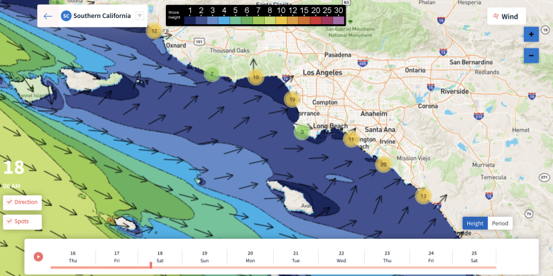
SATURDAY MORNING
Lows on Saturday will be similar to that on Friday, maybe a degree or two cooler as the clouds break apart by then. The sun will be out and winds will remain light and offshore at around 5 mph for everyone except Oxnard where 10-15 mph winds are possible.
The westerly ground swell from the low off in the Pacific will be best early in the morning as it will gradually dissipate through the day. Waves will be largest near the border with 3-4 ft swells while the next biggest will be near Oxnard with 2-3 ft swells. Everyone else is looking at 1-2 ft swells with roughly 13 second periods.
SATURDAY AFTERNOON
Again, not much will be different in the afternoon hours other than the swell continuing to decrease. San Diego is looking at 3 ft swells max by the afternoon while everyone else will continue seeing 1-2 ft swells. Highs are forecasted to be in the mid-60s to near 70 for LA and with the sun out, it will be a nice day for beginners.
Winds will die almost completely down around 2-3 pm before shifting to a very light onshore breeze at under 5 mph. This shouldn’t kick up any kind of wind swell. Periods slightly decrease to around 10-11 seconds by the afternoon.
SUNDAY MORNING
We will have a very similar morning on Sunday with lows in the mid to upper-40s across the area. Winds will either be very light offshore or there will be no wind at all, perfect for surfing. Sadly, the swell during this period will be extremely weak everywhere with 2ft heights expected for west facing beaches and 1 ft heights for south faces.
Winds will stay pretty consistent through the morning but periods could become variable across the area during this period. On average, expect 11-13 seconds.
SUNDAY AFTERNOON
Nothing major is expected to occur for Sunday afternoon. The biggest thing would be that towards sundown we will start to see the west ground swell pick up slightly as the beginning of a potential event for next week. All around though, waves are expected to remain pretty weak with 3ft swells near the border being the biggest in the area. 1 ft swells are expected for south faces and 2ft swells for west faces.
Winds will stay light through the day although we may see a transition to an onshore breeze. Again, we expect this breeze to remain light at around 5 mph so surfing will still be possible despite the small waves. Periods during this time frame will be highly variable and hard to predict but everyone should see 11+ seconds.