Overview:
Plenty of waves on the way this week as the South Pacific has cranked out multiple good-sized storms bringing swell our way to SoCal. We will see fun, rideable surf throughout the forecast, but the biggest days will be the 13th to the 15th as two locally solid Southern Hemisphere swells overlap.
The first swell of the bunch will build all day Sunday the 12th, and peak into Monday the 13th. This swell will hold size pretty steadily Tuesday the 14th, until the second slightly larger swell builds in through the day Tuesday while overlapping with the first.
This second swell will eventually top out Wednesday the 15th, where we will see the biggest size in the forecast. Note, this second pulse does have a bit more south to it, so not all breaks will see size bigger than the first pulse. There will be minimal NW energy in the water, so it’s going to be super lined-up with not many corners at the beach breaks. Those summer breaks with a point or structure will be the best spots to target.
Pretty seasonal September weather persists into this week’s forecast. High pressure will continue to dominate the West Coast for most of the week, resulting in high temperatures in the mid to high 70s for the coastal areas.
Conditions wise, mornings will see light winds, followed by a typical afternoon sea breeze. Right now it’s looking like the strongest afternoon onshores will be over the weekend, but there should still be a few afternoons with manageable conditions with the run of swell we have on the way.
Local water temperatures are still in the mid to high 60s, and not much of a change is expected through this week.
Best Bets
– Target the good sized run of Southern Hemisphere swell the 13th through the 15th
– Know your limits during the peak of the swell
– Mornings will be the best window every day, before afternoon onshore wind picks up
See the full 10-Day Forecast >
Day to Day Breakdown
Thursday the 9th: 2-3 feet
The beginning of the forecast will be starting out on the smaller side, but still rideable. The swells in the water will consist of a mix of leftover Southern Hemi from last week, and some new energy showing late. Morning winds will be light with calm conditions, while the afternoon looks to remain on the lighter side too. Inland areas could see some thunderstorm activity as monsoonal moisture increases, with a small chance of some of that activity drifting into the coastal areas down south (Orange county to San Diego).
Friday the 10th: 2-3 feet
Similar to Thursday for the size department and swell in the water. Just some small Southern Hemisphere energy showing for the summer spots. Morning winds will be calm for most areas, with a chance of some minor texture on it for some spots further south around San Diego. Afternoon winds don’t look too bad either.
Saturday the 11th: 2-3 feet
Continued mix of small south swells. Late in the day we should start to see some forerunners of the first respectable south swell, but it will not be adding any more size for most spots. Morning winds will be light with calm conditions, followed by a stronger westerly sea breeze nearing 10 knots.
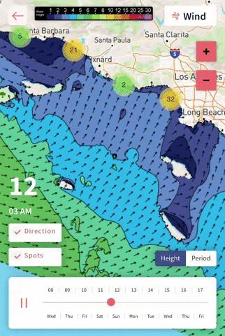
Sunday the 12th: 3-4+ feet (larger sets late)
The beginning of the much anticipated run of Southern Hemisphere swell. The morning will start off slow with some inconsistency, but through the day more size and energy will show as the swell builds in. Morning winds will be favorable, but unfortunately the afternoon looks problematic as stronger west winds are forecasted.
Monday the 13th: 4-7+ feet
One of the biggest days in the forecast. The first Southern Hemisphere swell builds to a peak. The result is locally solid sized waves for the summer spots across SoCal (even bigger than the numbers above), so this is definitely a day to target. Morning winds will be pretty light, with the chance of a slight bump on it through the morning as west winds already pick up. These afternoon onshores are looking similar to the weekend, so best to get on things early before it gets blown out for those unprotected areas.
Tuesday the 14th: 4-7+ feet
Another locally solid day of waves as the first south swell holds pretty steadily, while the second slightly larger swell builds in late. Again, select summer spots will see larger sets than the numbers above. This second pulse building through the day has more south in it, so it will be more selective than the first. Morning winds are looking pretty favorable, so that will definitely be the window for the best surf. Afternoon onshores are expected again.
Wednesday the 15th: 4-7+ feet
Another good morning of surf in store, with even more size than the past two days at select south facing breaks. These select summer spots will still see sets bigger than the numbers above. Size will hold all day, as this second pulse of Southern Hemi peaks. Right now, morning winds are looking favorable, so that will be the best window of the day.
– Jax Richards @jax6street
If you’d like to receive these day by day forecasts every week, sign up for our newsletter